
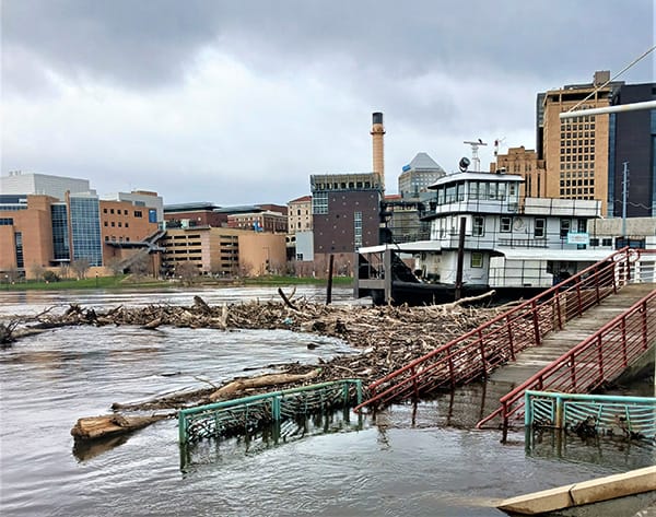
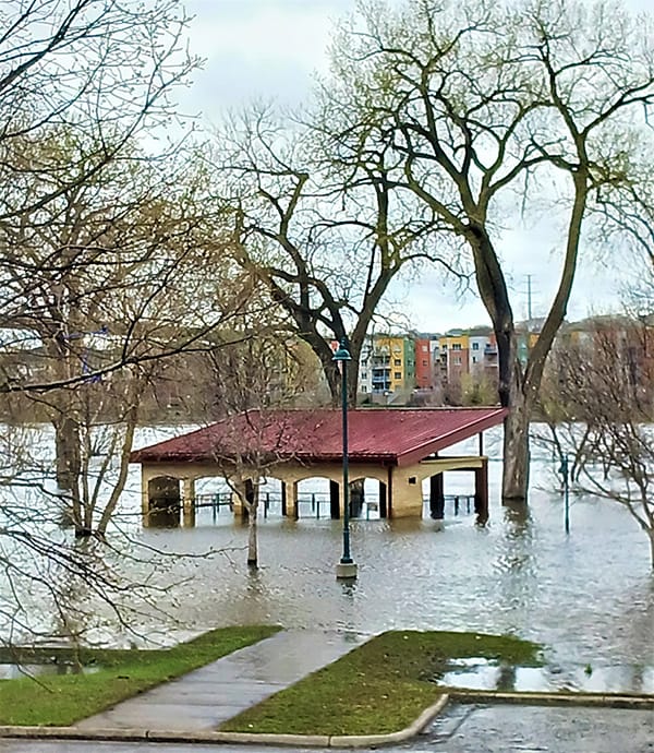
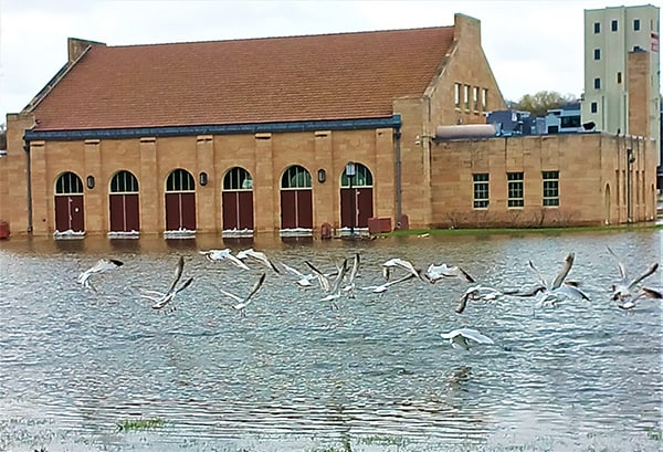
Winter was tough in Minnesota this year. But spring may prove to be just as difficult. Most rivers in the state are at or above flood stage, the Mississippi among them.
For those of you who’ve read my novel This Tender Land, on the river journey the four Vagabonds undertake in the summer of 1932, they land their canoe at the Westside Flats in Saint Paul. In 1932, the Westside Flats was an area predominantly settled by poor immigrant populations, Eastern European Jews most prominently. They created a close-knit community on this land that was, at the time, dirt cheap. Why dirt cheap? Because almost every spring the Mississippi River spilled over its banks and flooded the Flats. In recent years, dams on the river have tended to mitigate the flooding.
I shot the photos and video at Harriet Island, adjacent to the spot where the Vagabonds in my story landed. As you can see, despite the flood control efforts of the Army Corps of Engineers, the Westside Flats still flood on occasion. In our hubris as humans, we believe we can control Nature. Every so often, Nature reminds us who’s really the boss.

So glad I don’t live close to a river or stream.
Was Lilydale underwater for a long time? I remember when I was in college in the mid-60’s that it flooded so badly almost every year, that eventually they moved out all the housing and made it a regional park.
BTW how are you dealing with the huge gap of the St. Clair Broiler closing? I used to hang out there, and was hearbroken to see it closed on my last visit to St. Paul around 7 years ago.